Overview
Technology is anything but foolproof. We come to rely on it at our own peril. I am well aware of this, yet when it comes to my sense of direction I’ve completely lost it to that vexing app known as Google Maps.
I moved to Louisville, KY, over two years ago, and I still can’t navigate my neighborhood without firing up the smartphone. That’s not good. There’s no doubt that if the SHTF I’d be Sh*t out of luck.
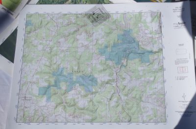
I need a backup plan. And that plan may very well be printed maps from MyTopo.com. They’re waterproof, fully customizable and they ship out to you within 24 hours.
Specs
- Fully Customizable
- Ship Within 24 hrs
- Waterproof
- Topographic, Aerial, Satellite Prints
- All of U.S. & Canada (Public and Private Land)
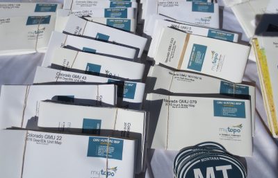
- USGS Quads (United States Geological Survey) or GMU (Game Management Units)
Impression
Paul Helinski, the owner and founder of GunsAmerica, has reviewed MyTopo maps for his prepping 101 series in the past. In fact, that’s what led me to check them out here at SHOT Show 2017. I wanted to get a feel for the quality of the maps. As Paul said in his review, they are thinner than expected but they still seem rather durable.
I suggest you check out his detailed article as he goes step by step throughout the customization process to show you what you get at each price step. He also had one other little critique that I won’t spoil.
As for me, and like Paul, I’m a convert. I’m going to order one of my neighborhood in Louisville. While I won’t be shutting off the Google Maps anytime soon, I will rest a little easier knowing I have one sitting at home.
Pricing and availability
The MyTopo maps start at $9.95 and go up in price to $319.00. You can order the maps on the website here. They ship out on the same day, so you won’t have to wait long to receive yours.


i.e. they print maps available from the U. S. Geological Survey (https://nationalmap.gov/ustopo/index.html) on high quality stock. Cool. I’m bookmarking their site.
Good Thanks for getting out this companies product at this the 1st month of 2017. I can barely read any of these “simple to use” electronic map/GPS devices while enjoying solitude out in the field. As I age naturally, the parts that get week first seem to be (close vision) and (detailed hearing), then manual dexterity and some youthful wisdom in trekking. Then remembering how to operate with-out 3 booklets on how to start sync,reboot and maintain charge of your electronic everything device. A detailed USGS map is, always at hand ready to be interpreted as needed. That’s if you learned how to reconnoiter,The area in question.
Doing That alone in it’s self is lost among the populace, much like skills of Routing. or describing features to remember?. “What just follow the Sign’s” or “Stay on the Path” . You are never lost just LOST.